
Surveys
ECOSYSTEM SURVEYS
St. Andrews Biological Station biologists coordinate and lead the Maritimes Region annual Ecosystem Surveys of the Scotian Shelf, Bay of Fundy, Gulf of Maine and Georges Bank. Since 1970, these surveys have gathered information on the abundance and distribution of:
- commercially important groundfish;
- aquatic species at risk; and
- other non-commercial fish and invertebrate species.
These surveys monitor environmental conditions, along with species abundance (how many), distribution (where they live) and diversity (different species types) to track ecosystem status. Four techniques are used including:
- bottom trawl;
- hydrographic sampling;
- vertical plankton tows; and
- hydroacoustics.
Data is collected on all captured fish and invertebrate species, the physical and chemical properties of seawater and the type and abundance of phytoplankton and zooplankton (very small and microscopic plants and animals).
These surveys are important fisheries-independent tools to estimate populations and the ecosystem over time by measuring:
- stock abundance (size of marine populations);
- recruitment (number of young fish or juveniles); and
- biological considerations (growth, condition, diet, reproductive stage).
The survey results are summarized each year and provided to Resource Management for decision making. This information is used, along with data from fisheries catches, to assess the status of commercial species, such as cod, haddock, pollock, halibut, offshore lobster, shrimp, etc., but also non-commercial species such as skates, flatfish and squids.
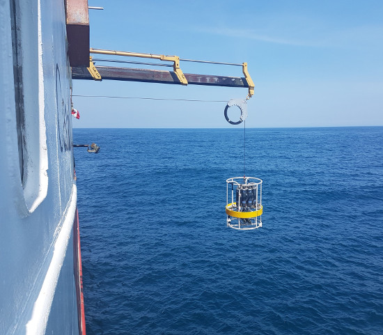
Photo of a CTD used to measure conductivity, temperature and depth of water
As technology has advanced, hydrographic samples collected have changed significantly. Originally, only surface and bottom water samples, and temperature profiles were taken. Since 1990, temperature, salinity and oxygen data have been collected with a CTD (conductivity, temperature, depth) measurement tool. In the last two decades, nutrient and chlorophyll measurements have been added. In more recent years, vertical zooplankton and phytoplankton have been measured. This combination of hydrographical and trawl data provides more detailed information on the ecosystem and has become the basis for a wide variety of ecosystem studies.
HYDROACOUSTIC SURVEYS
Hydroacoustic surveys use sonar technology to continuously sample the water column and count marine and freshwater species. This provides vital information for estimating the abundance and distribution of a variety of species. St. Andrews Biological Station researchers have been using hydroacoustics for assessing the herring in Nova Scotia and the Bay of Fundy since 1998. Industry now conducts hydroacoustic surveys of herring spawning grounds during the spawning season and shares this information with biologists to be included in the stock assessment.
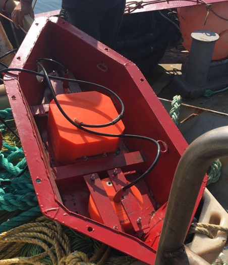
Photo of a scientific echosounder system used to perform offshore acoustic surveys
Hydroacoustic methods have also been developed with the goal to gain a better understanding of the abundance of groundfish stocks, such as pollock, haddock, cod, redfish and dogfish from the Bay of Fundy and Scotian Shelf offshore ecosystem surveys.
Other hydroacoustic studies at the Station include studying the interactions between wild forage fishes and salmon aquaculture; developing a method to use multi-beam sonar to estimate the population size of the Saint John River Shortnose Sturgeon (listed as Special Concern by COSEWIC); and developing an index of Bluefin Tuna abundance in the Gulf of St. Lawrence from herring hydroacoustic surveys.
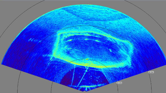
Photo of a multi-beam sonar capturing movement of Bluefin tuna within a sea pen
DID YOU KNOW?

- DFO Science staff work around the clock sampling fish and invertebrate species captured in the bottom trawl. These species are identified, counted and the total weight for each species is recorded.
- For most fish and invertebrates caught, length and weight measurements are taken to monitor condition or plumpness. Some species are sampled to determine sex and maturity.
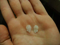
- Otoliths (ear bones) or scales are taken from many commercial fish species for ageing. During the summer survey, stomachs are removed from select fish species and the contents are identified to better understand diet and feeding habits.
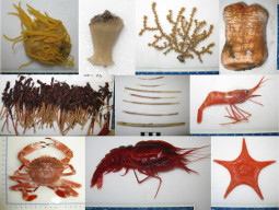
- Specimens that cannot be identified are photographed, frozen and retained for later identification.